


Quirigua
with Dr. Robert Stewart, National Geographic
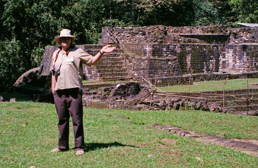
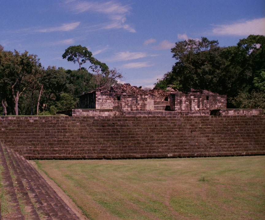
Quiriguá is an ancient Maya archaeological site in the department of Izabal in south-eastern Guatemala. It is a medium-sized site covering approximately 3 square kilometers (1.2 sq mi) along the lower Motagua River, with the ceremonial center about 1 km (0.6 mi) from the north bank. During the Maya Classic Period (AD 200–900), Quiriguá was situated at the juncture of several important trade routes. The site was occupied by 200, construction on the acropolis had begun by about 550, and an explosion of grander construction started in the 8th century. All construction had halted by about 850, except for a brief period of reoccupation in the Early Postclassic (c. 900 – c. 1200). Quiriguá shares its architectural and sculptural styles with the nearby Classic Period city of Copán, with whose history it is closely entwined.
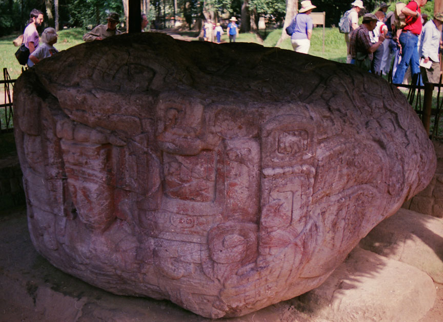
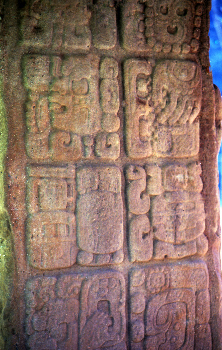
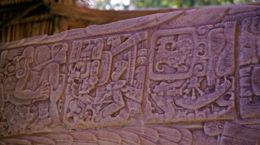
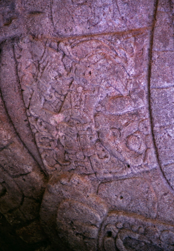
Quiriguá's rapid expansion in the 8th century was tied to king K'ak' Tiliw Chan Yopaat's military victory over Copán in 738. When the greatest king of Copán, Uaxaclajuun Ub'aah K'awiil or "18-Rabbit", was defeated, he was captured and then sacrificed in the Great Plaza at Quiriguá. Before this, Quiriguá had been a vassal state of Copán, but it maintained its independence afterwards. The ceremonial architecture at Quiriguá is quite modest, but the site's importance lies in its wealth of sculpture, including the tallest stone monuments ever erected in the New World.
The archaeological site of Quiriguá is named after the nearby village of the same name, and is located a little over 200 km (120 mi) northeast of Guatemala City; it lies in the municipality of Los Amates in the department of Izabal and has an elevation of 75 m (250 ft) above mean sea level.
Positioned on the north bank of the lower reaches of the Motagua River, Quiriguá is situated at the point where the valley broadens into a flood plain, which has exposed the site to periodic flooding over the centuries. Although the river passed close to the site during the period of the city's occupation, it has since changed course and now flows 1 km (0.6 mi) south of the ceremonial centre.[3] Quiriguá is 48 km (30 mi) north of Copán, and is located 15.7 km (9.8 mi) north-west of the international border with Honduras.
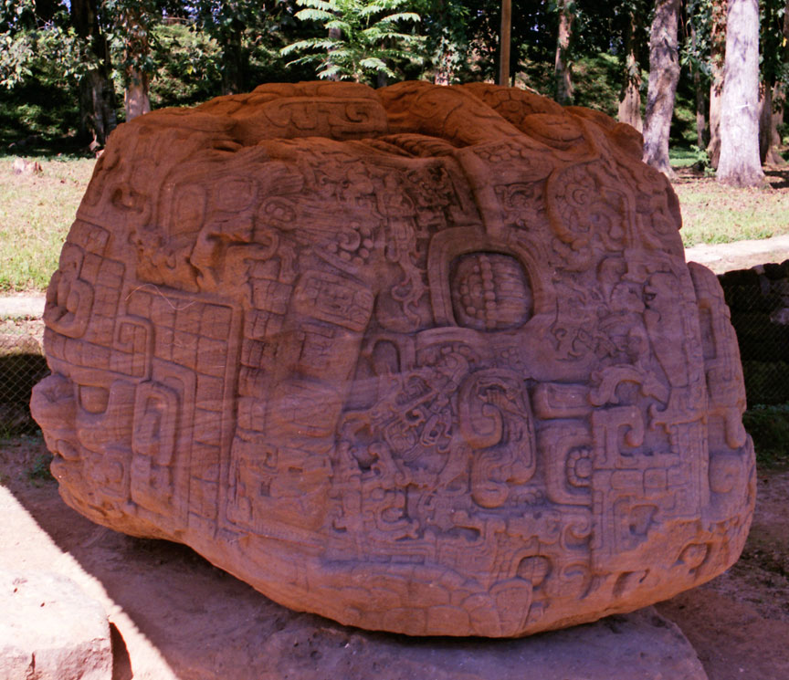
The local bedrock is a hard red sandstone, which the inhabitants used in the construction of monuments and architecture. This local sandstone is very strong and not prone to shearing or fracturing, and allowed the sculptors at Quiriguá to erect the tallest freestanding stone monuments in the Americas. Quiriguá was built directly over the Motagua Fault and the city suffered damage in ancient times as a result of major earthquakes.
Quiriguá was declared a National Monument in 1970 under Ministerial Accord 1210, this was followed on 19 June 1974 by its declaration as an Archaeological Park under Governmental Accord 35-74.
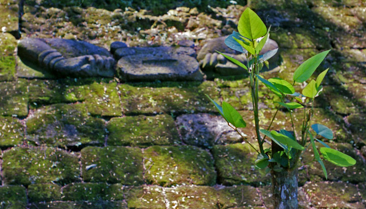
From 1974 through 1979, an extensive archaeological project was conducted at Quiriguá sponsored by the University of Pennsylvania, the National Geographic Society, and the Guatemalan Instituto de Antropología e Historia. Directed by Robert Sharer and William R. Coe, the project excavated the acropolis, cleaned the monuments and studied outlying groups. It was declared a UNESCO World Heritage Site in 1981, and in 1999 UNESCO approved one-off funding of US$27,248 for "emergency assistance for the rehabilitation of the archaeological site of Quiriguá". One of the site's stelae is depicted on the Guatemalan 10 centavo coin.
Text from Wikipedia
forest logging

banana harvest