


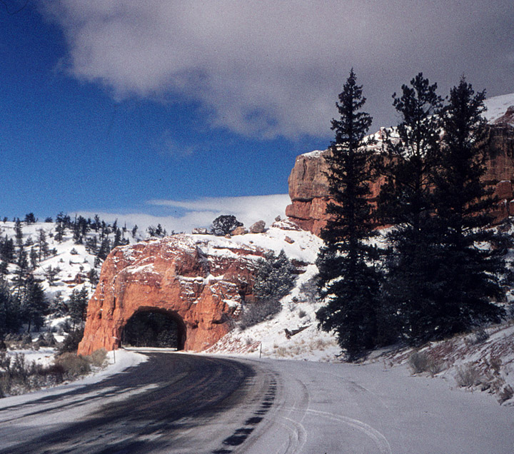
Winter
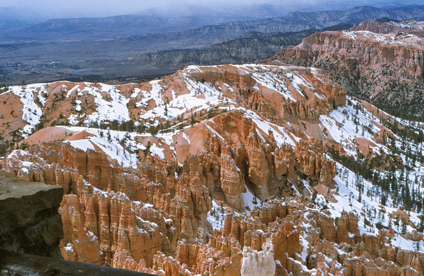
Bryce Canyon National Park is a national park located in southwestern Utah in the United States. Contained within the park is Bryce Canyon. Despite its name, this is not actually a canyon, but rather a giant natural amphitheater created by erosion along the eastern side of the Paunsaugunt Plateau. Bryce is distinctive due to its geological structures, called hoodoos, formed from wind, water, and ice erosion of the river and lakebed sedimentary rocks. The red, orange and white colors of the rocks provide spectacular views to visitors.
Bryce is at a much higher elevation than nearby Zion National Park and the Grand
Canyon. The rim at Bryce varies from 8,000 to 9,000 feet (2400 to 2700 m),
whereas the south rim of the Grand Canyon sits at 7,000 feet (2100 m) above sea
level. The area therefore has a very different ecology and climate, and thus
offers a contrast for visitors to the region (who often visit all three parks in
a single vacation).
The canyon area was settled by Mormon pioneers in the 1850s and was named after
Ebenezer Bryce, who homesteaded in the area in 1875. The area around Bryce
Canyon became a U.S. National Monument in 1924 and was designated as a national
park in 1928. The park covers 56 mi² (145 km²). The park receives relatively few
visitors compared to Zion Canyon and the Grand Canyon, largely due to its remote
location. The town of Kanab, Utah is situated at a central point between these
three parks.
Bryce Canyon National Park is located in southern Utah about 50 miles (80 km)
northeast and 1000 feet (300 m) higher than Zion National Park. The weather in
Bryce Canyon is therefore cooler, and the park receives more precipitation. A
nearby example, very similar to Bryce Canyon but at a higher elevation, is in
Cedar Breaks National Monument.
The national park lies within the Colorado Plateau geographic province of North
America and straddles the southeastern edge of the Paunsagunt Plateau west of
the Paunsagunt Fault (Paunsagunt is Paiute for "home of the beaver"). Park
visitors arrive from the plateau part of the park and look over the plateau's
edge toward a valley containing the fault and the Paria River just beyond it (Paria
is Paiute for "muddy or elk water"). The edge of the Kaiparowits Plateau bounds
the opposite side of the valley.
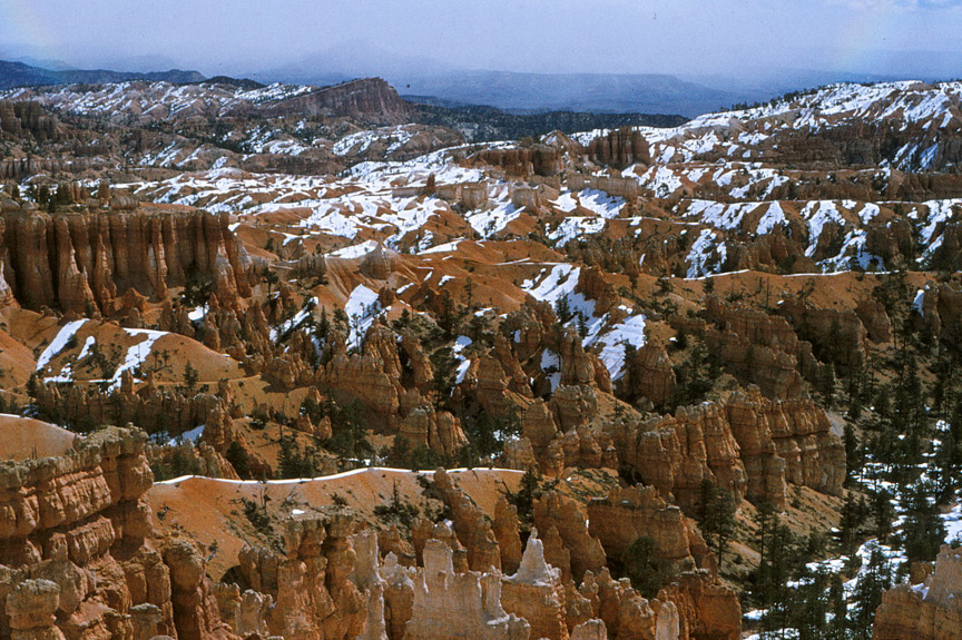
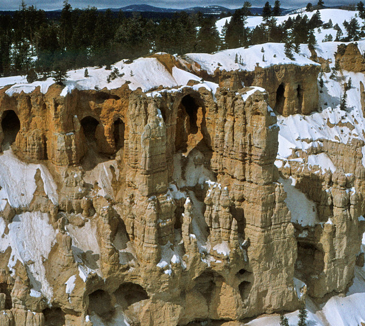
Bryce Canyon was not formed from erosion initiated from a central stream,
meaning it technically is not a canyon. Instead headward erosion has excavated
large amphitheater-shaped features in the Cenozoic-aged rocks of the Paunsagunt
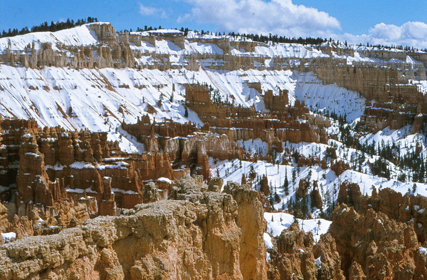
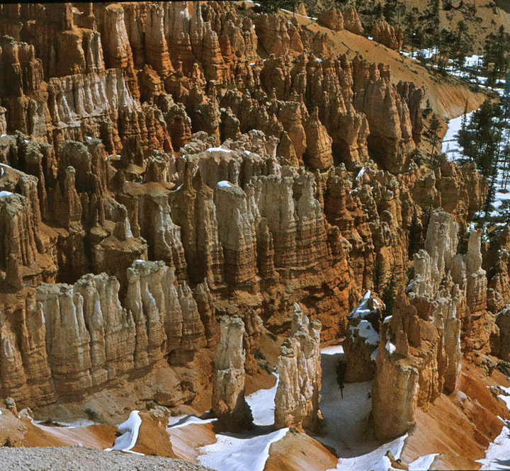
Plateau. This erosion exposed delicate and colorful pinnacles called hoodoos
that are up to 200 feet (60 m) high. A series of amphitheaters extend more than
20 miles (30 km) within the park. The largest is Bryce Amphitheater, which is 12
miles (19 km) long, 3 miles (5 km) wide and 800 feet (240 m) deep.
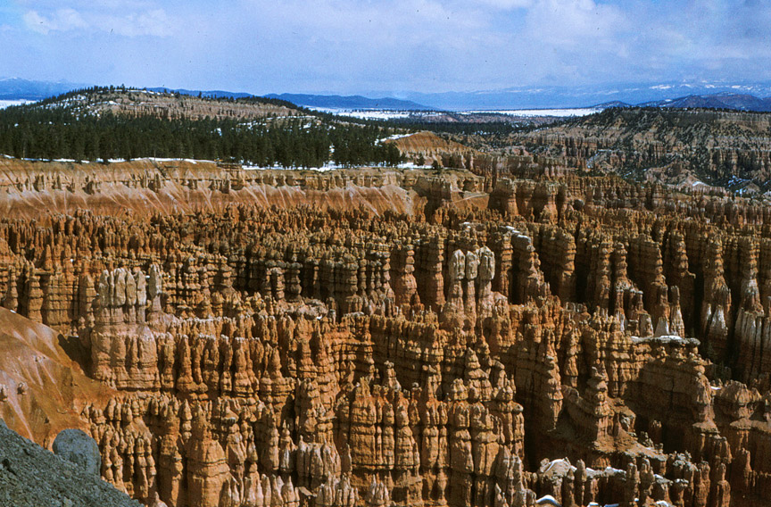
The highest part of the park at 9,105 feet (2,775 m), Rainbow
Point, is at the end of this scenic drive. From there, Aquarius Plateau, Bryce
Amphitheater, the Henry Mountains, the Vermilion Cliffs and the White Cliffs can
be seen. Cope Canyon, where it exits the park in the north-east section, is the
lowest part of the park at 6,600 feet (2,011 m).
Text from Wikipedia
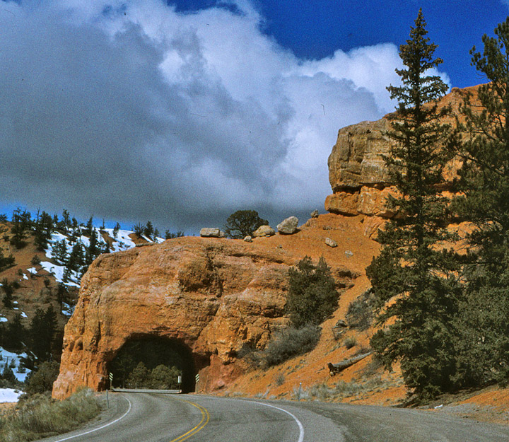
less snow