


Faial Island


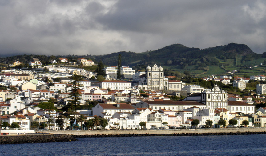
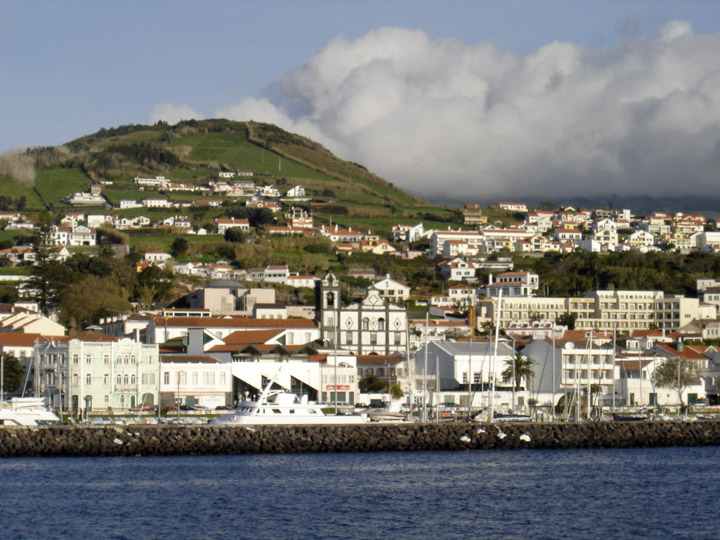
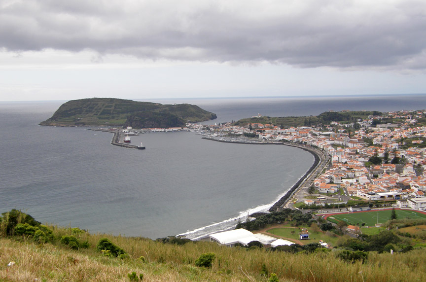
Horta
Faial Island , also known in English as Fayal, is a Portuguese island of the Central group (Grupo Central) of the Azores. Its area is 173 km² and it is located 28.7° W longitude and 38.6° N latitude. The nearest island is Pico Island to the east. The island is also referred to as Ilha Azul (the "Blue Island"), by poet Raul Brandão, due to the large quantity of Hydrangeas that bloom during the summer months.
The original name of Faial (aka Fayal) was Ilha da Ventura or Insula de La Ventura (Venture Island) and it was possibly discovered by navigator Diogo de Silves, while in the service of the King of Portugal, in 1427. In 1432 a small group of Portuguese settlers came from Terceira Island to settle in the northern pasturelands of Cedros. Queen Isabela of Burgundy authorized the settlement of lands on the island. Flemish settlers under contract from the crown, and led by the nobleman Josse Van Huerter, came to shore at Praia de Almofariz (now Praia de Almoxarife) in the east of the island. A lack of potable fresh water resulted in a move to preceding valley, which today carries their name (Flamengos). According to the testimony of Henry the Navigator the island was then known as São Luís (Ilha de São Luís). By 1490, this Flemish community numbered approximately 1500 people. The Flemish joined with more Portuguese settlers and eventually formed Vila da Orta (later simply Horta). Some time later the island's name changed to "Fayal", due to the large number of Fayal trees [Myrica faya Aiton]. With the island's improving economy more Portuguese settled there and rapidly the Flemish influence diminished.
Horta harbor
During the Iberian Union of Portugal and Spain, the island was frequently attacked by British and French pirates between 1589 and 1597. Raiding parties from the Count of Cumberland (Sr. Walter Raleigh) and Count of Essex attacked the defenseless populations between 1589 and 1597. These privateers robbed the inhabitants and burned what they left behind. The Faialese people, to protect themselves, built a large number of fortresses; in the 18th century there were more than 20. The Cabeço Gordo Volcano erupted in 1672, leading to emigration to Brazil, but the economy was not significantly damaged.
the "Polar Star" at the Horta dock
In intervening years Horta became a stopover for Jesuit missionaries traveling to and from Brasil and Asia. The Jesuits constructed a college in Horta, as did the Carmelites and Franciscan Orders. The explorer James Cook also reached the islands before initiating his Pacific voyages of discovery, during the 1700s.
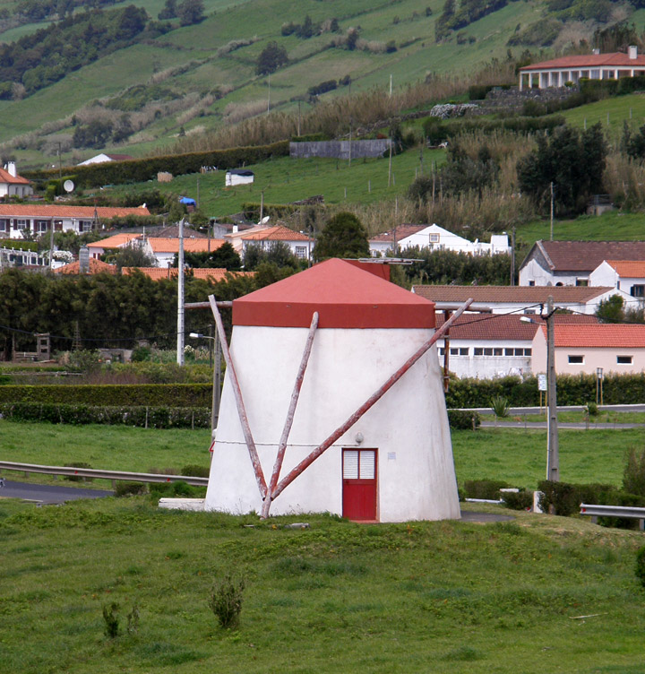
former windmill
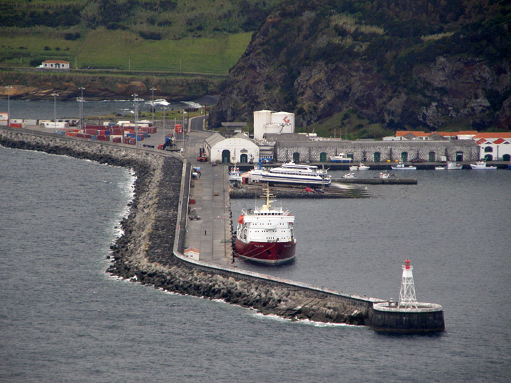
In 1876 work started on the construction of a dock in the protected harbor of Horta. As time progressed, Faial's importance expanded through this dock, as a waypoint to trans-Atlantic traffic. Charles William Dabney, the American entrepreneur was responsible for the growth of the industry of the islands with whaling, wine and orange exports predominating. A philanthropic figure, Dabney was responsible for cultivating the economy of the island and supporting its population, aid to agriculture and generating markets abroad for their goods. The growth of industry and trans-Atlantic sail traffic also expanded Horta's importance, as a safe harbor and coal storage base. In 1919, the first airplane to cross the Atlantic stopped at Horta. Horta's exceptional situation also led to Pan American establishing a Clipper base there. Similarly, British, American, French, German and Italian intercontinental submarine cable stations were based in Horta. During World War 2, Horta was also an important naval base, giving shelter to Allied fleets that took part in the Normandy invasion.
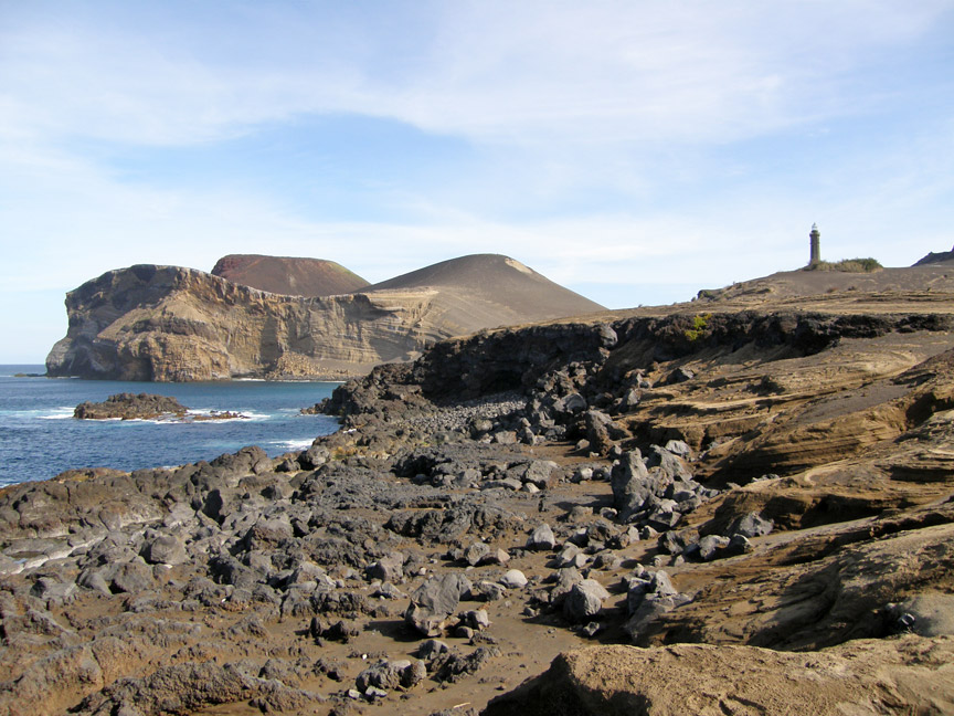
Capelinhos Vulcano, Faial Island,
Azores.
The lighthouse marks the old position of the Ponta dos Capelinhos.
More Photos of Capelinhos Vulcano
The island, dependent on whaling and agriculture, remained prosperous until the
eruption of Capelinhos volcano in 1957. Communities of the northern and western
coast were harshly affected by the volcano's eruption, as agricultural lands
were untillable and covered with sand and ash. This led to the immigration of
4000 people to the United States, spearheaded by members of the Portuguese
diaspora in New England and an influential Massachusetts Senator (John F.
Kennedy). In addition, whaling, as a viable commercial enterprise was slowly
curtailed with innovations in the chemical sector and animal-rights influence.
Economic and political changes since the 1980s have helped to revitalize the
islands economy and development. After the Azores gained the status of an
Autonomous region in Portugal, Horta, the island's city, was allowed to host the
regional parliament (parlamento regional) of the Azores.
Part of the Central Group of islands (with Pico, São Jorge, Graciosa and
Terceira), the pentagonal-shaped island occupies an area of approximately 172
km² (22 km east-west and 15 km at its widest point). Faial is hilly; the highest
mountain, the Cabeço Gordo Caldera, is 1,043 metres high and the inner crater is
2 km wide and 500 metres deep. The deepest part of the crater is filled with a
lake.
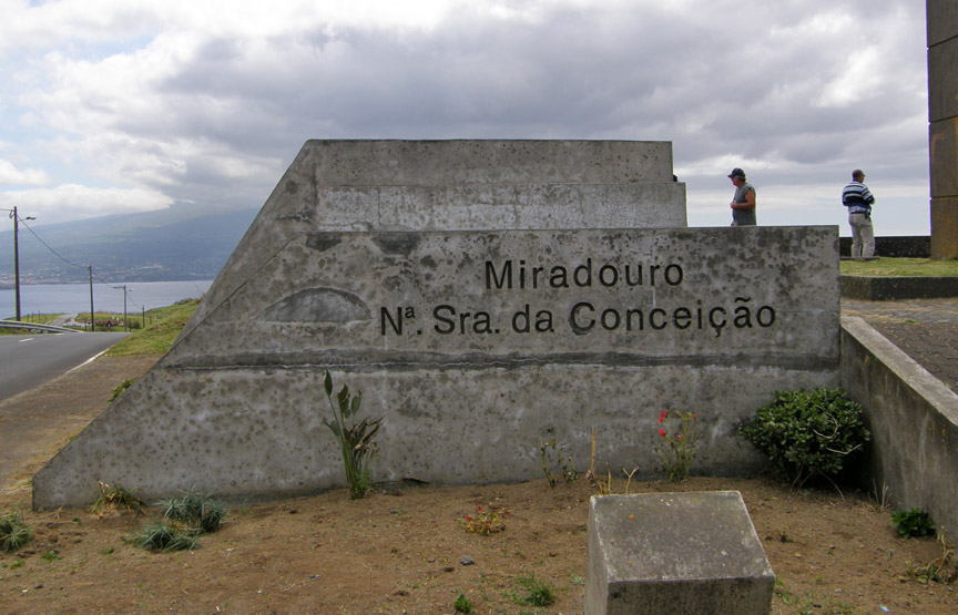
The town of Horta (located on the southeast coast of the island) remains the
centre of community activity on the island. Owing to its situation, it provides
wonderful views of the Island of Pico, and sometimes of São Jorge. The town is
flanked by Ponte de Espalamaca, Monte da Guia (remnants of another volcanic
cone) and Monte Carneiro. Excellent views of the town and ocean are visible from
any of these points. A road that circles the island from Horta takes visitors to
the north, west and southern areas of the island. The river valleys along this
route divide small communities from each other: Praia de Almoxarife and Pedro
Miguel are just two of the communities in the eastern river valleys. Then one
comes to Riberinha, where pastures sheltered by a ridge covered with rich
vegetation give the district a special beauty. Salão provides lovely vistas of
fields hedged by hydrangeas. A few kilometres further, is Cedros, a village that
is believed to be the oldest settlement on the island. Proceeding further north,
the ocean cliff slopes become steeper near the communities of Praia do Norte,
where from Costa Brava, 320 m high, there are fine views over Fajã. The volcanic
black lava and deep vegetation continues in the areas around Fajã da Praia do
Norte and Norte Pequeno.
Along with other islands in the Azores archipelago, the island is of volcanic
origin and is close to the tectonic divide between the European and American
plates. Indeed, the island can be considered the westernmost point of Europe
(the two islands west of Faial, Flores and Corvo, are already on the American
plate). Relatively small in size in comparison to the Pico, the centre of the
island is dominated by Cabeço Gordo and its Caldeira. Until 1957 the island was
circular (20 km x 25 km). The last eruption occurred near the small parish of
Capelo on September 27, 1957. At first, the Vulcão dos Capelinhos formed a small
islet, near the western part of Faial. But the volcano became active again on
December 16, 1957; this lasted until May 12, 1958 and connected the islet with
Faial, effectively enlarging the island by 2.4 km² and forming the "Ponta dos
Capelinhos". This area is now considered a national refuge and ecological
sensitive zone with limited access to the dormant cone.
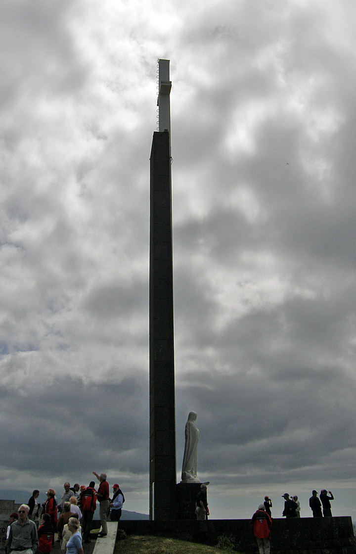
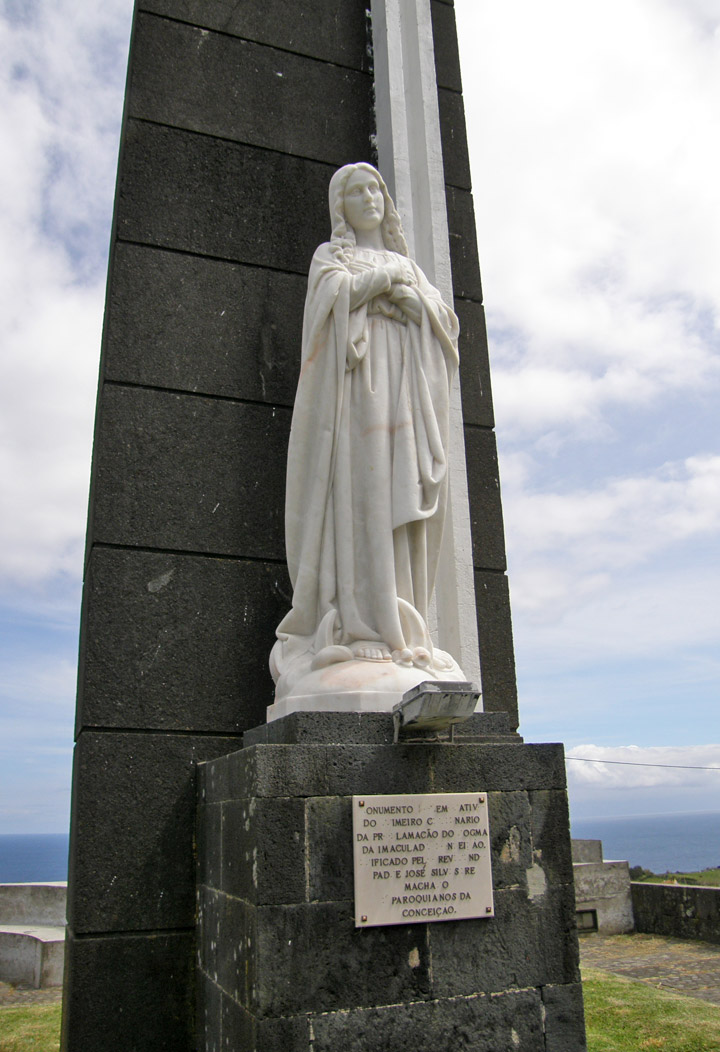
at night large candles a lit to venerate the Virgin
The southern coast is a delightful panorama. Here Varadouro, the southern spa
region, is dominated by an attractive bay and the black rock cliffs of the
Castelo Branco (Mouro). The Varadouro spa, and its hypersaline waters at a
temperature of 35.5ºC (96ºF) are available to beachgoers who travel to
ocean-carved pools for refreshment. Castelo Branco and Feteira highlight the
rough coast and pasturelands near the city of Horta. Lajinha and Ponta Furada
(near Horta) is an area of caves and strange lava arches formed during the
creation of the island.
The interior landscape is different. On Monte Carneiro (overlooking the city)
there is a point from which excellent views are available, in particular the
Vale dos Flamengos on account of its plantations, flowers and cottages. Other
places of interest are edged by hydrangea and rustic forests to places of great
interest: Largo Jaime de Melo, Riberia do Cabo, Riberia Funda, etc.
building destroyed in the 1998 earthquake
Faial has been affected by various earthquakes and seismic events during the
populated history of the island. The most important has been the 1759-1760
earthquakes and aftershocks tremors occurring the Christmas and New Years.
Similar in nature, the 1926 earthquake rumbled the city of Horta, in
early-April. The island saw a series of intensive earthquakes. On April 5,
damages were reported in Flamengos, Ribeirinha and Conceição. On August 31 at
08:42(local time) causing 8 deaths ruining the cities of Horta again and
parishes of Conceição, Praia do Almoxarife (ruining 220 homes), Flamengos,
Feteira and Castelo Branco and most of Lomba do Pilar and Salão. The total and
partial damages to the earthquake were 4,138 homes and buildings. Similar
tremors and events were felt in 1957/1958 (Capelinhos eruption) 1963 and 1973.
The 1998 Azores earthquake on July 9 shook Faial, Pico and São Jorge at 07:19
measuring 5.6 on the Richter scale with and epicentre NNE of the island of Faial
caused damages to the parishes of Riberinha, Pedro Miguel, Salão and Cedros and
stronger damages in Castelo Branco (mainly Lombega), Flamengos and Praia do
Almoxarife on Faial, it also caused damages in parts of Pico Island and the far
western part of the São Jorge Island. 8 persons lost their lives in the
earthquake, 1,700 persons were homeless.
Faial's economy is based on agriculture and related industries, cattle, and
tourism. Its fast economic growth was propelled by the production of a blue-coloured
pastel plant that was used for dyes.
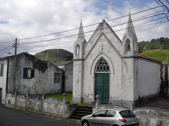
school
The economy of the island generated some prosperity until 1957, when the Capelinhos Volcano erupted in the western part of the island, reactivating emigration to North America, supported by promises of aid made by Massachusetts senator John F. Kennedy to the affected populations.
The main agricultural resources of the island are potatoes, cereals, fruits, and wines, along with cattle (which makes up its dairy and meat industry). The city of Horta is the centre of commerce and services of the island.
More Photos of the Botanical Garden
In the 1960s, Portugal experienced economic growth, and an airport was opened; with it, tourists came. After Portugal's entry into the EEC, the standard of living rapidly grew and today the population generally prospers.
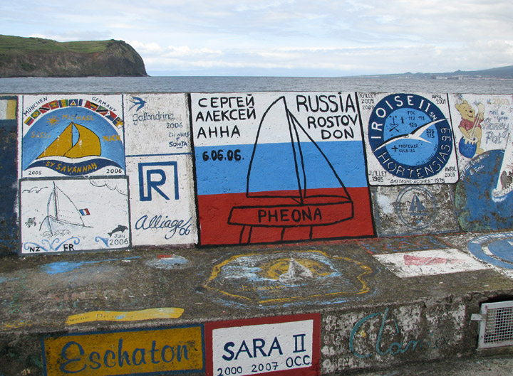
harbor a famous stopover for trans-Atlantic boating
Faial's population is 14,785 (in 2003). The only city on the island, Horta
(9,563 inhabitants) has a port and a marina.
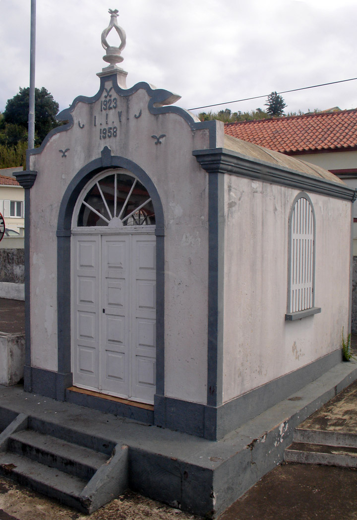
Espírito Santo chapel
There are several festivals on Faial, the most important ones being in the summer. The most popular ones are the Espírito Santo festivals occurring throughout the island between Ascension Day and August. Saint John is the patron saint of Horta, being celebrated has São João da Caldeira.
The island, like some other Azorean islands, produces cheeses and other milk
products, along with cow meat, and by-products notable in Portugal, and it has a
rich cuisine that also includes local sea-food.
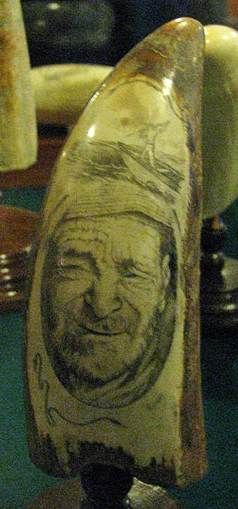
Scrimshaw
Scrimshaw, handiwork made of whale teeth, is a traditional craft of the Azores. However, because of the prohibition on whale hunting in Portugal, some designs of this can easily cost hundreds of Euros, due to the rarity of whale teeth.
Text from Wikipedia
Photos of the Whale Oil processing factory